Nov 9, 2026
How to score landslide terrain risk for a supplier site
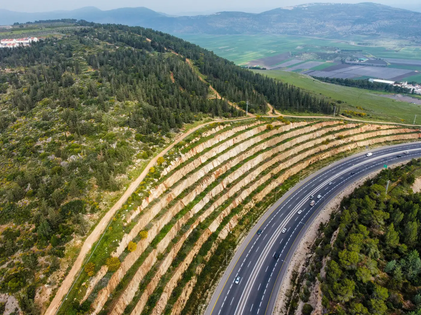
Most supplier risk registers have a line for flood. Almost none have a line for landslide, even though a facility built into a cut slope, served by a switchback access road, or sitting on a valley fill can lose power, road access, or the building itself in a single storm season. Landslide terrain risk gets skipped more often than flood risk, mostly because scoring it looks harder than pulling a FEMA flood layer. It isn't, once you know what to check.
What drives landslide exposure at a facility
Four things matter more than the rest:
- Slope angle at and around the site, not just the pad the building sits on
- Soil and substrate: residual soil over fractured bedrock moves very differently than consolidated rock
- Cut and fill geometry on access roads and parking areas, which are often the first thing to fail in a storm
- Prior slide history in the surrounding terrain, still the single best predictor of future movement
A supplier can sit on a flat pad halfway up a mountainside and still be exposed, if the access road switchbacks through a cut slope above it or the loading dock backs onto a fill slope with no retaining structure. Score the terrain around the site, not just the parcel boundary.
Turning that into a score
A workable scoring approach doesn't need a geotechnical engineer on staff. Three tiers cover most registers:
- Low: slope under roughly 15 degrees, no visible cut or fill slopes above the site, no slide scarps nearby
- Moderate: moderate slope, some cut or fill geometry near the access road or pad, or thin soil over bedrock
- High: steep terrain, visible slide scarps or debris fans upslope, or fill slopes directly supporting structures or roads
You assign a tier to each supplier site based on what current high-resolution imagery shows: the slope gradient, whether cuts or fills are present, and whether there's evidence of past movement nearby, like a debris fan, a bare scarp, or a patch of younger vegetation where older growth was stripped away. Flagging it takes a recent image and someone who knows what a slide scar looks like from above.
Where the generic-layer shortcut breaks down
The usual shortcut is pulling a regional landslide susceptibility layer, the kind published at county or state scale, and matching your supplier's address to a polygon. That tells you the region is prone to landslides. It doesn't tell you whether your supplier's specific pad, access road, and loading dock sit in the exposed part of that polygon or on a flat bench a half mile from the actual slope. Procurement ends up with a register that cites a real source and still can't answer the question that matters: is this site, the one with your supplier's name on it, actually in the hazard path.
The gap widens at renewal. Terrain doesn't move every year, but site conditions do. A supplier who widened their yard last year by cutting into the hillside behind it didn't file that with a county planning office. A three-year-old susceptibility layer has no way of knowing.
Scoring a full footprint, not one site at a time
None of this is slow to do for a single supplier. It gets slow fast across two hundred sites, which is usually how the spreadsheet method started in the first place: someone ran out of hours before they ran out of suppliers to check. Supply Chain Hazard Mapping screens a full vendor list against current high-resolution imagery once a year, flags landslide terrain alongside flood plain, wildfire fuel load and storm surge, and returns a numbered register entry per site: hazard type, exposure tier, and the imagery basis for the call.
A supplier register that still treats landslide as a line item nobody filled in is cheaper to fix before the next renewal than after the next storm season.